
Kanyakumari District Administration
Kanyakumari District, the southernmost district of Tamil Nadu, is renowned for its rich cultural heritage, stunning landscapes, and efficient administration. This page provides comprehensive information about the Kanyakumari district administration, including its governance structure, key departments, and public services. Whether you’re a resident or a visitor, explore how the district administration works to ensure the well-being of its people and the development of the region.
Overview of Kanyakumari District
Kanyakumari District, located at the tip of the Indian peninsula, is a unique blend of natural beauty and cultural diversity. Known for its pristine beaches, historic temples, and vibrant traditions, the district is a popular tourist destination. The administration plays a crucial role in maintaining the region’s infrastructure, economy, and social welfare.
- Geography: Surrounded by the Arabian Sea, the Indian Ocean, and the Bay of Bengal.
- Population: Approximately 2 million people (as per the latest census).
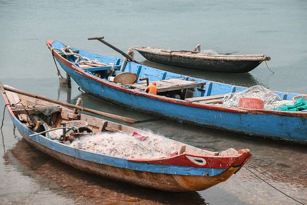
- Economy: Agriculture, fishing, and tourism are the primary economic drivers.


Governance Structure
The Kanyakumari district administration is headed by the District Collector, who oversees various departments and ensures the implementation of government policies. Key administrative bodies include:
- District Collector’s Office: Responsible for revenue collection, law and order, and public welfare.
- Panchayats and Municipalities: Handle local governance and community development.
- Key Departments:
- Revenue Department
- Police Department
- Education Department
- Health and Family Welfare Department
- Agriculture Department
Public Services
The district administration provides a wide range of services to residents and businesses. Some of the key services include:
- Revenue Services: Land records, property registration, and tax collection.
- Healthcare: Government hospitals, primary health centers, and vaccination drives.
- Education: Government schools, scholarships, and literacy programs.
- Tourism Development: Promotion of tourist spots and infrastructure development.
- Emergency Services: Disaster management and relief operations.
Tourism in Kanyakumari District
Kanyakumari is a major tourist hub, attracting visitors from across the globe. The district administration plays a vital role in promoting tourism and maintaining tourist spots. Some of the must-visit places include:
- Kanyakumari Beach: Famous for its sunrise and sunset views.
- Vivekananda Rock Memorial: A symbol of spiritual enlightenment.
- Thiruvalluvar Statue: A tribute to the great Tamil poet.
- Padmanabhapuram Palace: A historic wooden palace.
- Mathur Hanging Trough: The tallest aqueduct in Asia.
Key Initiatives by the Administration
The Kanyakumari district administration has launched several initiatives to improve the quality of life for its residents. Some notable programs include:
- Swachh Bharat Mission: Cleanliness drives and waste management programs.
- Skill Development Programs: Training for youth to enhance employability.
- Digital India Campaign: Promoting e-governance and digital literacy.
- Agricultural Support Schemes: Subsidies and training for farmers.


Corporation
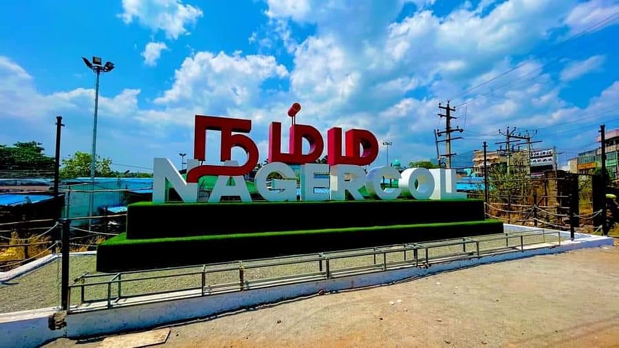
Nagercoil
Nagercoil’s unique combination of strategic location, natural resources, diverse industries, and entrepreneurial culture makes it one of the richest and most dynamic cities in Tamil Nadu. Nagercoil’s economy is not dependent on a single industry. It thrives on a mix of food processing, flower markets, cottage industries, and other businesses, ensuring resilience and steady growth.
Municipalities
Padamanapuram
Thuckalay, located in the Kanyakumari District of Tamil Nadu, is emerging as a vibrant business center with a diverse range of industries. From corporate companies to construction firms, the town is a hub of economic activity, catering to both local and regional needs.


Colachel
Colachel, a coastal town in Kanyakumari District, Tamil Nadu, is a hub of diverse economic activities. The town is primarily known for its thriving fishing industry, agriculture, and the proposed development of a seaport, which is expected to boost its economic growth further.
Kuzhithurai
Marthandam is a bustling commercial and trade center located in the Kuzhithurai Municipality of Kanyakumari District, Tamil Nadu, India. Situated along the National Highway, it serves as a key economic hub in the region. Historically, Marthandam was known as Thoduvetty


Kollemcode
One of the historically significant temples in Kanyakumari District is the Kollemcodu Bhadrakali Amman Temple. It is believed that couples who pray here for the blessing of a child are granted a child.
Kanyakumari Administration Revenue Divisions
the administrative structure of Kanyakumari District in Tamil Nadu, India, remains largely consistent with the information you provided from three years ago. However, there may have been minor changes or updates in local governance, infrastructure, or development projects. Below is a summary of the current administrative setup and key updates for Kanyakumari District:
Administrative Divisions (Taluks)
Kanyakumari District continues to be divided into six taluks:
- Agastheeswaram
- Kalkulam
- Vilavancode
- Thovalai
- Thiruvattar
- Killiyur
Blocks
The district has nine blocks, which are:
- Agastheeswaram
- Rajakkamangalam
- Thovalai
- Kurunthancode
- Thuckalay
- Thiruvattar
- Killiyur
- Munchirai
- Melpuram
Municipalities and Local Governance
- Municipal Corporation: Nagercoil (the largest urban center and administrative headquarters of the district).
- Municipalities: Padmanabhapuram, Colachel, Kuzhithurai, and Kollemcode.
- Village Panchayats: The district has 95 village panchayats and 55 special category village panchayats, which are responsible for local governance in rural areas.
Major Towns
The major towns in Kanyakumari District include:
- Nagercoil
- Kanyakumari (Cape Comorin)
- Padmanabhapuram
- Colachel
- Kuzhithurai
- Marthandam
- Thuckalay
- Thiruvattar
- Eraniel
- Kaliyakkavilai
- Arumanai
- Melpuram
- Kulasekharam
Challenges
- Deforestation and Environmental Degradation:
- The Western Ghats in Kanyakumari are facing significant deforestation due to the extraction of rocks and minerals. These rocks are being carved out at an alarming rate to support construction projects, including the development of the Vizhinjam Port in the neighboring Kerala district. This has led to the destruction of natural habitats, loss of biodiversity, and increased vulnerability to landslides and soil erosion.
- The rapid depletion of natural resources is threatening the ecological balance of the region, which is known for its rich flora and fauna.
- River Pollution:
- The rivers in Kanyakumari, particularly those flowing from Kerala, are facing severe pollution due to the dumping of medical waste, meat waste, and other industrial effluents. This pollution is exacerbated by the lack of strict enforcement of environmental regulations.
- The contamination of water sources is not only affecting aquatic ecosystems but also posing serious health risks to the local population, who rely on these rivers for drinking water, agriculture, and daily use.
- Agricultural Pollution:
- The excessive use of chemical fertilizers and pesticides in agriculture has led to the degradation of soil quality and contamination of groundwater. This is further compounded by the improper disposal of agricultural waste, which contributes to river pollution.
- Coastal Erosion:
- Parts of the Kanyakumari coastline are experiencing severe erosion, threatening coastal communities and ecosystems. Rising sea levels and unsustainable development practices are exacerbating this issue.
- Unemployment:
- Despite having a high literacy rate, the district faces challenges related to unemployment, particularly among the youth. The lack of diversified industries and job opportunities is a growing concern.
- Threats to Public Health:
- The pollution of rivers and natural resources is leading to the spread of waterborne diseases and other health issues among the local population. The improper disposal of medical and meat waste is particularly alarming, as it increases the risk of contamination and disease outbreaks.
- Inter-State Environmental Issues:
- The Kanyakumari District faces challenges due to its proximity to Kerala. The lack of coordinated efforts between the Tamil Nadu and Kerala governments to address cross-border pollution and environmental degradation is a significant concern. For example, the unchecked flow of waste and pollutants from Kerala into Kanyakumari’s rivers is causing long-term harm to the region’s ecosystems and communities.
Urgent Need for Action
- Strengthening Environmental Regulations: There is an urgent need for stricter enforcement of environmental laws to prevent deforestation, illegal mining, and pollution.
- Waste Management Systems: Improved waste management infrastructure is required to handle medical, industrial, and agricultural waste effectively.
- Inter-State Collaboration: The Tamil Nadu and Kerala governments must work together to address cross-border environmental issues and ensure the sustainable use of shared natural resources.
- Community Awareness: Raising awareness among local communities about the importance of environmental conservation and sustainable practices is crucial for long-term solutions.


Revenue Divisions
Census Details
District Profile
Kanyakumari District Major Economy
The economy of the Kanyakumari district is primarily agricultural, with coconut, rubber, and cashew being the major crops. The district is located in an area with a warm and humid climate that is conducive to the cultivation of these crops.
In addition to agriculture, the Kanyakumari district is home to a number of small and medium-sized industries, including textiles, food processing, and engineering. The district is known for its handloom and power loom industries, and for the production of coconut coir products.
Tourism is also an important contributor to the economy of the Kanyakumari district. The district is home to a number of popular tourist attractions, including the Kanyakumari Temple, the Vivekananda Rock Memorial, and the Padmanabhapuram Palace. These attractions draw visitors from all over India and the world, and contribute significantly to the local economy.
Overall, the Kanyakumari district has a diverse and dynamic economy that is driven by agriculture, industry, and tourism. It is an important contributor to the economy of Tamil Nadu and plays a vital role in the development of the region.
kanyakumari District sumup
The Kanyakumari district administration is committed to ensuring the well-being of its residents and the sustainable development of the region. By providing efficient governance and public services, the administration plays a pivotal role in making Kanyakumari one of the most vibrant districts in Tamil Nadu. Explore more about Kanyakumari’s culture, history, and tourism on our website.
Need Help?
FAQs
Here are the frequently asked questions related to Kanyakumari district
Who is the current District Collector of Kanyakumari?
The current District Collector of Kanyakumari is Tmt R. Alagumeena. You can check the official government website for updates.
Who is the current Revenue Officer of Kanyakumari?
The current Revenue Officer of Kanyakumari is Thiru J. Balasubramaniam. You can verify this information on the district administration’s official portal.
How can I contact the Kanyakumari district collector’s office?
Make an appointment before meeting the following persons:”
- Personal Assistant to the Collector: 04652 279889
- District Collector: 04652 279090
- Personal Assistant to the Collector (Noon Meal Programme): 04652 279048
- District Collector Email: collrkkm@nic.in
- Personal Assistant to the Collector Email: pagkkm@gmail.com
Which government schemes are available for residents of Kanyakumari?
Various central and state government schemes related to agriculture, education, housing, and employment are available. Visit the district administration website for details.
What is the official website of Kanyakumari district administration?
The official website of Kanyakumari district is https://kanniyakumari.nic.in/ . It provides government services, announcements, and administrative updates.
Who is the current Superintendent of Police (SP) of Kanyakumari?
The current Superintendent of Police (SP) of Kanyakumari is Dr. R. Stalin. For the latest updates, visit the Tamil Nadu Police website.
Who is the current Mayor of Kanyakumari?
The current District Collector of Kanyakumari is R. Mahesh. You can check the official kanyakumari government website for updates.
How can I contact the Superintendent of Police (SP) of Kanyakumari?
The general public can meet the District Superintendent of Police (SP) directly, without any assistance or recommendations, regarding their complaints and requests. Meetings are allowed daily from 12:00 PM to 2:00 PM.
It has been stated that actions will be taken without any external influence or recommendations, which is a welcome move!
Where can I find official updates about Kanyakumari district administration?
You can visit the official Tamil Nadu government website or the Kanyakumari district administration portal for verified information.
Where can I get official land and revenue records for Kanyakumari?
Land and revenue records can be accessed through the Tamil Nadu government’s e-services portal or by visiting the Revenue Department office in Kanyakumari.